Torre Salsa nature reserve: how to get there, the beach and the trails
Nature reserve 16 km from the Scala as the crow flies
.jpg)
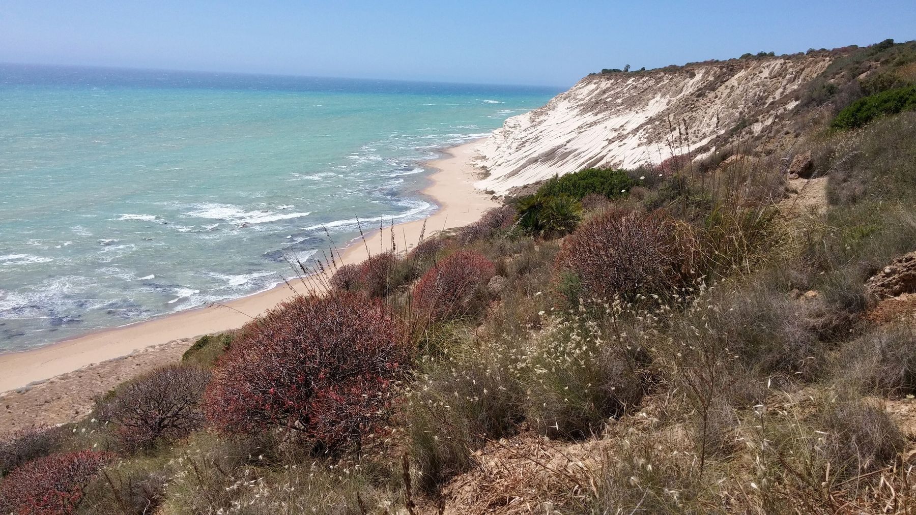
The Torre Salsa nature reserve is a stretch of about 6 km of protected coast in the municipality of Siculiana, with cliffs, dunes and sandy beaches, run by WWF since 2000. You get there from the SS 115, Siculiana Marina exit, and the ruined tower is 15.5 km from Scala dei Turchi as the crow flies. We found no mention of a ticket; according to a 2021 source there are no bars or beach clubs in the reserve, so bring your own water and food.
What is the Torre Salsa reserve?
It was set up by a decree of the Sicilian Region on 23 June 2000 and entrusted to WWF Italy. According to WWF it covers about 762 hectares, with a core zone A and a buffer zone B. The decree protects the coast, the crags where many birds of prey nest, the Pantano (a coastal marsh) where waterbirds stop and breed, and the layers of crystalline gypsum. Off the coast there is also a protected marine site, the "Fondali di Torre Salsa" (the Torre Salsa seabed).
How do you get there?
According to WWF, from Agrigento you take the SS 115 to the Siculiana Marina exit, then the SP 75 towards Montallegro for about 2 km, to the "Francesco Galia" visitor centre in the Omomorto area. There are four entrances:
- Visitor centre, Cannicella and Eremita, all on the SP 75;
- Pantano, off the SS 115 at the Montallegro exit.
Without a car, WWF mentions buses to Siculiana and Montallegro from Sciacca, Agrigento and Palermo; we have not checked connections from there to the reserve. From Scala dei Turchi, Siculiana Marina is about 10.8 km by road.
How do you get to the beach?
According to Balarm, in summer the Pantano dries out and a farm track leads down to the sea; in winter and early spring the area can be flooded and impassable. For winter, Wikipedia recommends the paved stretches. According to WWF, in 2020 there was a single access to the sea, provided by the managing body, and parking was run by private operators: we have no confirmation for 2026.
About the cliff known as the Dama Bianca (the White Lady), some Komoot users warn that the area is largely private and that access to the beach is unclear. Follow the signs on site.
Which trails are there?
WWF describes a route on dirt tracks from the visitor centre to the orchid garden, then to the juniper valley and the abandoned quarries, with views of the coast. The network follows mule tracks and old drove roads. WWF publishes no names, lengths, difficulty levels or times, and OpenStreetMap has no waymarked hiking routes here, only some thirty unnamed path sections. The routes suggested on Komoot are generated by users and algorithms, not official. In zone A you must stay on the paths.
What can you see?
- Plants. According to WWF, the Mediterranean scrub is home to more than 20 species of wild orchid and the last Phoenician junipers; in spring the reserve is covered in flowers.
- Birds and other animals. The Pantano is a wetland rich in birds, and the coast is a stopover for many migrants in spring and autumn. Porcupines and the Sicilian pond turtle live here too.
- Ruins. The ruined Torre Salsa tower, from the second half of the 16th century, the remains of the Pantano tower, four Byzantine tombs and a small lime kiln.
- Sea turtles. WWF documented loggerhead turtle (Caretta caretta) nests on the reserve's beach in 2015 and 2017.
Plants, birds and the seabed are covered in more detail in our guide to nature and turtles.
Which rules apply?
The regulations attached to the 2000 decree say, among other things:
- in zone A walking is free, but you must not leave the paths, camp, bivouac or light fires;
- you must not pick plants, take away rocks, minerals or fossils, even fragments, disturb wildlife or touch nests and eggs;
- fishing and music without headphones are banned;
- motor vehicles may only use existing roads, not mule tracks and paths;
- in zone B you must not take sand or camp outside equipped areas.
According to WWF, the managing body also regulates the flow of bathers in summer. The regulations do not mention dogs: what to know if you travel with one is in our guide to Scala dei Turchi with a dog.
When should you go?
WWF does not give a best time. It does say that in spring the reserve is covered in flowers; in summer, according to Balarm, the Pantano is dry and you can get to the sea. Migratory birds pass through in spring and autumn. Opening times and tickets are not published: for up-to-date information, write to or call the reserve's WWF office on Via Roma in Siculiana, using the contacts on the reserve's page.
Which entrance should you use?
Choose the entrance according to what you want to do: the visitor centre for the trails, the Pantano for the beach in summer. Bring water, food and a hat, take your rubbish home and don't take anything away, not even a pebble. Further west, about 5 km away as the crow flies, is Eraclea Minoa, with its beach and Capo Bianco.
Frequently asked questions
How do you get to the Torre Salsa nature reserve?
According to WWF, which runs the reserve, from Agrigento you take the SS 115 to the Siculiana Marina exit and then the SP 75 towards Montallegro for about 2 km, to the visitor centre. There are four entrances: the visitor centre, Cannicella and Eremita on the SP 75, and Pantano off the SS 115 at the Montallegro exit.
Is the Torre Salsa beach free?
We found no mention of a ticket: the WWF page gives neither opening times nor fees. According to WWF, in 2020 there was a single access to the sea and parking was run by private operators; according to Balarm, in 2021 there were no bars or beach clubs in the reserve.
Are there hiking trails at Torre Salsa?
Yes, on dirt roads, mule tracks and old drove roads: WWF describes a route from the visitor centre to the orchid garden, the juniper valley and the abandoned quarries, with views of the coast. Official lengths and difficulty levels are not published.
How far is Torre Salsa from Scala dei Turchi?
The ruined tower is 15.5 km from Scala dei Turchi as the crow flies. By car, aim for the Siculiana Marina exit of the SS 115: Siculiana Marina is about 10.8 km by road from the Scala, and the visitor centre is about 2 km from there.
Is there a nude beach at Torre Salsa?
We don't know: we found no reliable source saying so either way. Bear in mind that it is a nature reserve with its own regulations, and that the WWF office is the place to ask for up-to-date information.
Can you bring dogs into the Torre Salsa reserve?
The reserve's regulations, attached to the 2000 decree, do not mention dogs. They do ban disturbing wildlife and, in zone A, leaving the paths: ask WWF before you go.