Capo Rossello: the lighthouse, the beach and the marl west of Scala dei Turchi
Place 2 km from the Scala as the crow flies
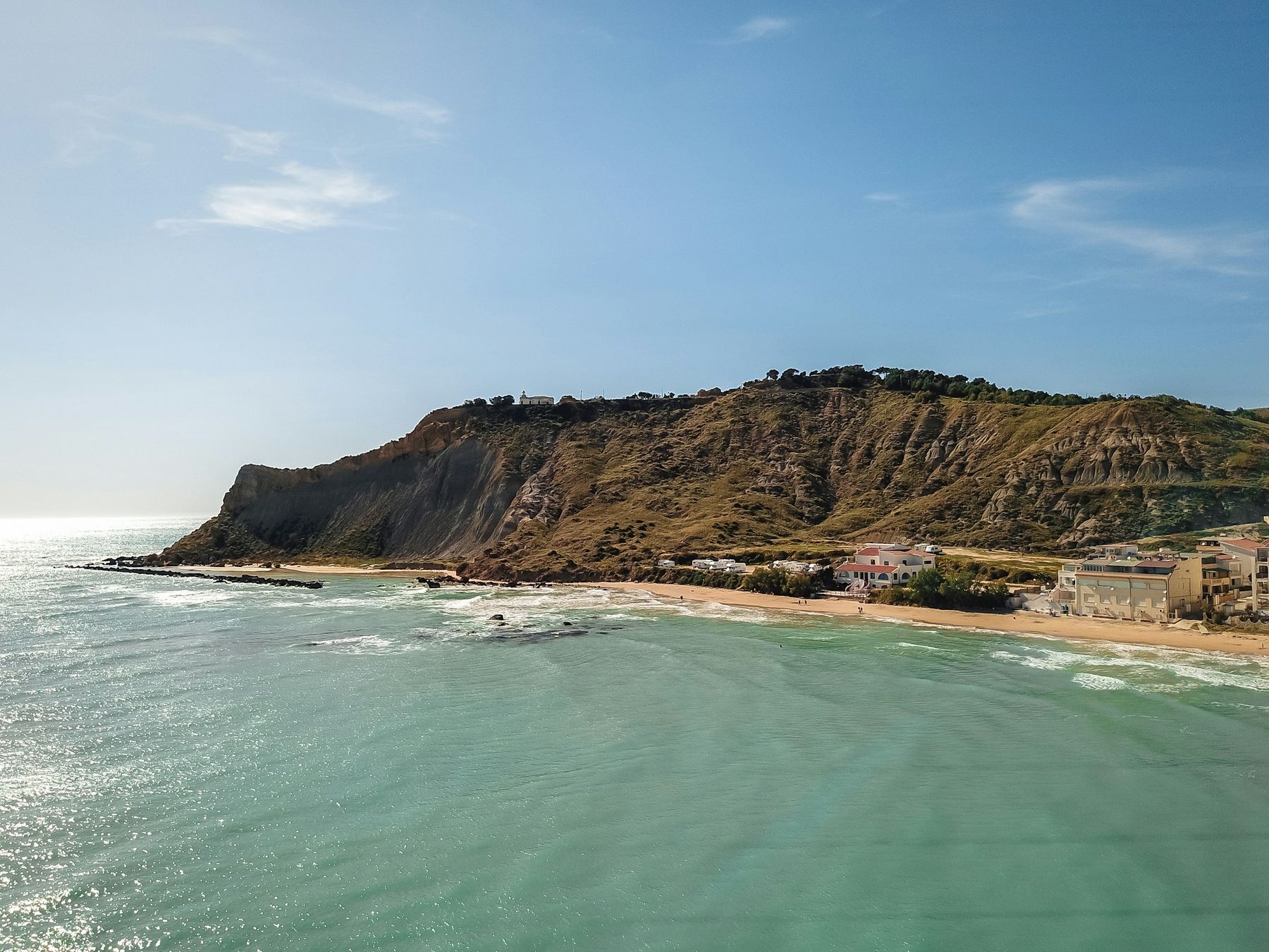
Capo Rossello is the headland with a lighthouse just west of Scala dei Turchi (the Turkish Steps), in the municipality of Realmonte: the lighthouse is about 2 km from the cliff as the crow flies. At its foot lies the beach that maps call "Capo Rossello beach", which is the beach of Lido Rossello. For visitors it is mainly a viewpoint over the coast; for geologists it is the name of a reference section of the Pliocene.
Where is the Capo Rossello beach?
It is the beach of Lido Rossello: OpenStreetMap calls it "Spiaggia di Capo Rossello" and places it in the Lido Rossello area, between the headland and the Scala. It is 1.4 km from the cliff as the crow flies and about 2.8 km by road. The Portale Acque, the Italian Ministry of Health's bathing water portal, rates its water as excellent, with six samples in 2026 all within limits. Access, beach clubs and parking are covered on the Lido Rossello page.
How do you get there?
By car you reach Lido Rossello from the SP 68, the provincial road between Realmonte and Porto Empedocle. Along the same road is the viewpoint area of Scala dei Turchi and Monte Rossello, where panels explaining the geology of the coast were put up in 2024.
According to OpenStreetMap, the lighthouse is about 700 metres west of the beach. We found no sources on a road or path open to the public up to the lighthouse, nor on visits to the building. Wikipedia lists a "Monte Rossello lighthouse" among the sights of Realmonte, probably the same one, but the entry is flagged for insufficient sources. If you go, stay on existing paths and respect fences and signs.
What can you see from Capo Rossello?
The coast, in both directions. According to a review from a few years ago, the lighthouse gives a good view of the Scala from above; a visitor touring the area in a wheelchair in 2016 wrote that the best glimpses from the road come when you arrive from the west. Where to photograph the cliff, with or without a ticket, is explained in our guide to Scala dei Turchi photo spots.
The photo at the top is an aerial shot from 2019, from a series in which the author names the Capo Rossello beach in the caption of another image: it shows a brown headland furrowed by gullies, with the houses of a beach at its foot.
Why do geologists know Capo Rossello?
Along this coast, between Eraclea Minoa and Capo Rossello, are the most typical sites of the Trubi, the formation of marl and marly limestone that the Scala is also made of. The layers of Capo Rossello are the historical stratotype of the Zanclean, the first stage of the Pliocene: the type section proposed in 1973 by Cita and Gartner, before the GSSPs, the official reference points used today.
The cape also gives its name to the "Rossello composite", the reference section described by Langereis and Hilgen in 1991, on which the astronomical time scale of the Pliocene is based. It strings together the layers of Eraclea Minoa, Scala dei Turchi, Punta Grande and Punta Piccola. At Capo Rossello, below the marl, there are also the Arenazzolo sands, with clay levels: the change from those sands to the marl marks the end of the Messinian salinity crisis and the return of the open sea. The full story, in plain words, is in our guide to the geology of Scala dei Turchi.
Which rules apply?
- Cliffs. The 2026 beach safety order of the Porto Empedocle Coast Guard, which also covers the Realmonte coast, bans standing or walking within 10 metres of the top of sheer cliffs and of their base, and bans diving or jumping from the cliffs.
- Turtles. Loggerhead turtles (Caretta caretta) nest on this coast: respect fenced-off nests and read our guide to nature and turtles.
- Dogs and access to the lighthouse. We found no specific rules or bans.
When should you go?
For swimming at Lido Rossello, the bathing season runs from May to October. For photos of the coast and the sunset, see our guide on the best time to visit: we have no information specific to Capo Rossello.
Is it worth going up to the lighthouse?
Capo Rossello is more for looking at than for visiting: for the sea, go down to Lido Rossello; for the view of the Scala, use the verified viewpoints along the SP 68. The lighthouse remains an unknown: before you look for a way up, ask in the village whether you can get there, and from where.
Frequently asked questions
Where is Capo Rossello?
On the coast of Realmonte, in the province of Agrigento, just west of Scala dei Turchi: the lighthouse is about 2 km from the cliff as the crow flies. At the foot of the headland, on its eastern side, lies the beach of Lido Rossello.
Where is the Capo Rossello beach?
It is the beach of Lido Rossello: OpenStreetMap calls it Spiaggia di Capo Rossello. It lies between the headland and Scala dei Turchi, 1.4 km from the cliff as the crow flies, and its water is rated excellent in 2026.
Can you visit the Capo Rossello lighthouse?
We don't know: we found no sources on opening times, visits or a public road up to the lighthouse. According to a review from a few years ago, the lighthouse gives a good view of Scala dei Turchi from above.
Why does Capo Rossello matter to geologists?
The Trubi marl layers of Capo Rossello are the historical stratotype of the Zanclean, the type section of the first stage of the Pliocene, proposed in 1973 by Cita and Gartner; the point that defines the start of the Pliocene today is at Eraclea Minoa. The cape also gives its name to the Rossello composite section, on which the astronomical dating of the Pliocene was built.