Scala dei Turchi (Turkish Steps) in Sicily: what to see and how to visit
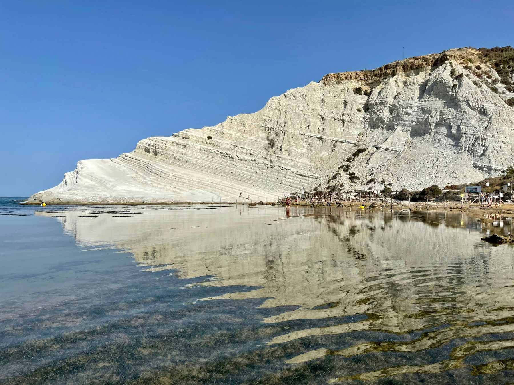
Scala dei Turchi, also known in English as the Turkish Steps, is a white marl cliff that drops to the sea in natural steps on the coast of Realmonte, near Agrigento in southern Sicily. Today it is a paid visit: you walk along the beach to the entrance, pay €6 and spend 20 minutes on the lower part of the headland. The upper steps, the ones in the most famous photos, are closed. The view from the beach and from the road above is free.
The photo at the top was taken in July 2021, before the current visiting rules. This page covers what you need to plan the visit and links to our detailed guides.
What is the white cliff of Realmonte?
It is a headland of pale rock that slopes into the sea in a series of ledges. On maps the cape is called Punta di Maiata. Italians also search for it as the "white cliff", the "Turks' bay" or the "Turks' beach"; in English it also goes by the Turkish Steps, Turkish Stairs or Stair of the Turks.
Since 2024 it has been on the geosite list of the IUGS, the International Union of Geological Sciences, for the layers geologists used to date the Pliocene period. It is also a 30-hectare Natura 2000 site, part of the European network of protected areas, with dunes, wild orchids and juniper. Since September 2023 the cliff has been public land, and the visit is run by the municipality of Realmonte.
Where is it? Realmonte, not Agrigento
The cliff belongs to Realmonte, a small town west of Agrigento. It sits along the SP 68, a provincial road towards Porto Empedocle, about 15 km by road from the centre of Agrigento. There is no direct access from the road to the rock: you go down to the beach and walk. Transport, distances and airports are in our guide on how to get to Scala dei Turchi.
How does the visit work today?
This is how it works in 2026 (many websites still describe the 2025 rules):
- Check that it is open. The site closes automatically in bad weather, choppy or rougher sea and for other safety reasons. The conditions and how to check them are on our page on whether Scala dei Turchi is open today.
- Park. There are paid car parks along the SP 68 and at the bottom of the Discesa Majata, a side road down to the sea, each with its own prices: see where to park.
- Walk down to the beach and along it to the entrance. First a steep flight of steps, then 10 to 20 minutes on the sand with no shade, according to visitors in 2026.
- Pay at the entrance. €6 per person. How to pay and what the sources say about booking are on our page on tickets and opening hours.
- Go in with your group. According to the mayor, as reported by the local news site AgrigentoNotizie in May 2026, visitors enter in groups of 50 every 20 minutes. The municipality's page, updated on 2 August 2026, gives opening at 08:00 and last entry at 19:40.
On the rock you follow a fixed route, and there are clear rules on shoes, equipment and litter: read the visiting rules before you go.
Can you climb the steps? What you see and what you don't
With a ticket you walk on the marl, but only on the lower part. The order of 8 May 2025 that reopened the visit allows a low section of the headland, with a set route in and out. The upper part and the famous "steps" remain closed for safety reasons: the cliff has had several rockfalls in recent years. Don't expect to sit at the top as people did in photos from a few years ago.
What you can still see:
- From the rock, the marl up close, with its white and grey layers.
- From the beach, for free, the whole cliff face. One visitor in around October 2026 called it the best viewpoint.
- From above, for free, from the clifftop road (see the section on photos below).
- From the sea, by boat, including the upper part you cannot reach on foot: departures and what to ask are covered in our guide from Agrigento to Scala dei Turchi.
How long do you need?
The visit on the rock lasts 20 minutes. The real time goes on everything around it: finding a parking space, the walk down, 10 to 20 minutes along the beach each way (uphill on the way back) and any wait for the next group, which goes in every 20 minutes.
If you also want to swim, our guide to the Scala dei Turchi beach explains where.
When should you go?
In summer, avoid the middle of the day: there is no shade between the car park and the rock, the white marl reflects the sun, and in extreme heat the municipality closes the site. In July 2026 it was shut from 11:00 to 18:00 on three heatwave days. Go early in the morning or late in the afternoon.
Sunset is the time many visitors recommend, but it does not always fall before the last entry. Month by month, with weather, sea temperature, sunrise, sunset and crowds, it is all in our guide on the best time to visit. According to the mayor, as reported by the local paper AgrigentoOggi, there were 33,800 visitors in August 2026, about seven in ten from abroad.
What should you bring?
- A payment card. Card only, at the entrance: that is what the municipality states for the ticket. Some visitors report weak mobile signal and a card reader that does not always work, so bring a physical card, not just your phone.
- Cash for parking and for the Apecar, a small three-wheeled vehicle that runs from the upper car park to the start of the beach.
- Shoes with soft, non-slip soles, which the municipality asks for to protect the marl. For the beach, several visitors recommend water shoes.
- Water, a hat and sunscreen. Since June 2026 the municipality has put up a few shade gazebos, but the route is still in full sun.
- A bag for your rubbish, to take back with you. We found no news that the public toilets announced in June 2026 have opened.
Is it suitable for children?
The way down to the beach is a steep staircase and the way back is uphill; according to a 2024 guide, the access by the Majata beach club avoids the steps but means about 1 km on sand. On the rock, one visitor notes there are no safety barriers, and the smooth marl is slippery when damp: hold children by the hand. Children entered free in 2024 (under 12) and 2025 (up to and including 12); for 2026 no official source confirms it, and two summer reviews say children over 12 pay. The ways down compared, the heat, pushchairs (strollers) and nearby beaches are in our guide to Scala dei Turchi with kids; if you travel with a dog, see our guide to Scala dei Turchi with a dog.
Why is it white?
It is made of Trubi marl, a rock formed mostly from the microscopic shells of plankton that settled on the seabed between about 5.3 and 3.6 million years ago, with very little clay. It is neither pure limestone nor clay. The steps form because rain, wind and sea wear away the softer layers first. More in our guide to the geology of Scala dei Turchi.
Why is it called Scala dei Turchi?
"Scala" (staircase) comes from the stepped shape; "Turchi" (Turks) from the name Sicilians gave to the North African corsairs who, according to tradition, landed on this coast. They were not from Turkey: they were Barbary and Saracen pirates, called Turks because their coasts were within the orbit of the Ottoman Empire. That is why you will also see it as the Turkish Steps or the Stair of the Turks.
We found no archive documents recording a landing at this exact spot, so the name rests on tradition: more in our page on the history of the name.
Is it a UNESCO site, and who owns it?
It is not a UNESCO World Heritage site, despite what many articles say: Realmonte asked for listing in 2007 and the Sicilian regional assembly passed a motion in 2019 asking the regional government to start the procedures for a bid, but nothing was ever inscribed. The 2024 recognition came from the IUGS, a scientific body. Ownership was disputed for years: access to the cliff was seized on prosecutors' orders in 2020, and on 26 September 2023 the private owner donated his plots to the municipality. The full timeline, including the red powder of 2022, is on our page on UNESCO, ownership and the news.
Where are the best photo spots, and can you fly a drone?
The best photos are free. From above, one visitor describes two lay-bys on the clifftop road between Realmonte and Porto Empedocle with a clear view of the cliff; stay well back from the edge, as a Coast Guard order bans standing within 10 metres of the top of sheer cliffs. From below, the beach gives you the whole wall. On the rock the municipality asks you not to rest equipment on the marl, so no tripod.
We found no specific municipal drone ban, but in the bathing season the Porto Empedocle Coast Guard bans low flights over beaches and sea without permission, and the mayor objected to unauthorised drone filming in 2025. Check with the Coast Guard or ENAC, the Italian aviation authority, and look up the zone on D-Flight, the Italian drone-zone map. Details are in our photo and viewpoint guide.
What else is there to see nearby?
The coast around has beaches, other pale cliffs and places that fit well with the visit:
- Punta Grande, the beach area just to the east, 0.9 km as the crow flies.
- Lido Rossello and the lighthouse of Capo Rossello, to the west.
- Porto Empedocle, just over 5 km by road: the real-life Vigata of Camilleri's Inspector Montalbano novels, and the Tower of Charles V.
- The Valley of the Temples, Agrigento's Greek temples, about 13 km by road. How to combine both in one day is in our guide from Agrigento to Scala dei Turchi.
- Torre Salsa and Eraclea Minoa, further west: a nature reserve run by WWF and an archaeological site near the white cliff of Capo Bianco.
All the places are in our list of places nearby; for accommodation, see where to stay and eat.
What do visitors say in reviews?
On Google Maps the Scala dei Turchi listing has an average of 4.5 from 6,382 reviews (figure from 12 October 2026). In the 2026 reviews we read, visitors praise the sunset and the free views from the beach and from above. About fifteen complain about paying for a short visit on rock with no visible upkeep and a dirty path; around six, between 2025 and 2026, only found out about the ticket after the walk, despite signs mentioning free access; four find it overrated compared with other white cliffs in the area that have no ticket.
Frequently asked questions
Is Scala dei Turchi in Agrigento or Realmonte?
It is in the municipality of Realmonte, in the province of Agrigento, on the coast between Porto Empedocle and Capo Rossello. From the centre of Agrigento it is about 15 km by road, roughly 25 minutes by car without traffic.
Why is it also called the Turkish Steps or Stair of the Turks?
Those are translations of the Italian name. Scala means staircase and refers to the stepped shape of the cliff; dei Turchi means of the Turks, after the North African pirates who, according to local tradition, landed on this coast. No archive record of a landing at this exact spot has been found.
Can you walk on Scala dei Turchi?
Only partly. With a ticket you walk on the white marl along a fixed route on the lower part of the headland. The upper part and the most photographed steps are closed for safety reasons.
Is Scala dei Turchi worth visiting?
If you want to walk on the white rock, yes, as long as you know it means 20 minutes on the lower part, reached only on foot along the beach. If you only want to look at it, the beach and the clifftop road are free, and some visitors write that the cliff is also seen well from above.
How long do you need at Scala dei Turchi?
You spend 20 minutes on the rock; the rest of the time goes on getting there. Allow for parking, the walk down, 10 to 20 minutes along the beach each way (uphill on the way back) and any wait for the next group to go in.
Is Scala dei Turchi a UNESCO site?
No. The town council asked for World Heritage listing in 2007 and the Sicilian regional assembly passed a motion in 2019 asking the regional government to start the procedures for a bid, but there has been no inscription. Since 2024 it has been on the geological heritage list of the IUGS, the International Union of Geological Sciences, which is not UNESCO.
Who owns Scala dei Turchi?
Since 26 September 2023 the land plots of the private owner who claimed the cliff have belonged to the municipality of Realmonte, which also runs the visit. The strip by the sea is state coastal land, held by the municipality under a concession since July 2022.
Where is the best photo spot, and can you fly a drone?
The free spots are the beach below the cliff, where you see the whole wall, and the clifftop road above it. We found no specific municipal drone ban, but in summer a Coast Guard order bans low flights over beaches and sea without permission; whether it covers drones is not confirmed, so ask the Coast Guard or ENAC, the Italian aviation authority, before flying.
Related guides
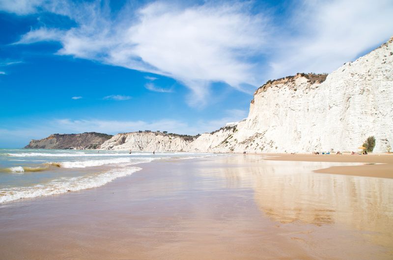
Scala dei Turchi beach: can you swim there, and which beaches are nearby
Can you swim at Scala dei Turchi? The beach below the cliff, beach clubs, water quality, kids, and nearby beaches such as Lido Rossello and Giallonardo.
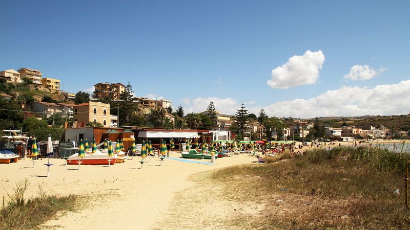
Scala dei Turchi with kids: the way down, safety and beaches nearby
Scala dei Turchi with kids or a pushchair: what the way down is like, safety on the rock, the heat, tickets and nearby beaches such as Lido Rossello.
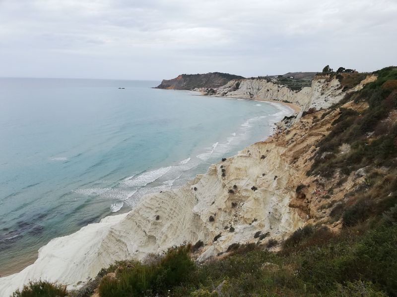
Photographing Scala dei Turchi: best spots, light and drone rules
Where to take the best photos of Scala dei Turchi: viewpoints, light at sunset, drone rules and permits for filming and professional shoots.